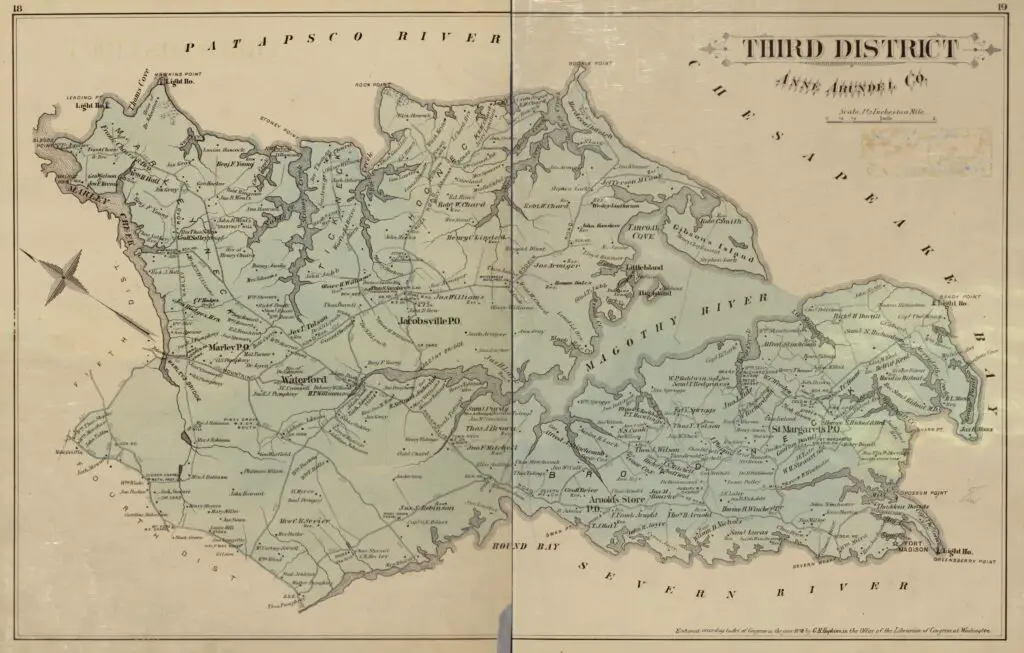
1877 Map of Anne Arundel County
Posted on
December 6, 2013
in
We Love Maps
Hereโs a cool old map of part of Anne Arundel County from 1877.
1877 map of Anne Arundel County
Source:
Library of Congress
Originally posted on
December 6, 2013
Baltimore in the 1870s
More from Ghosts of Baltimore
What Did Baltimore Look Like After the 1904 Fire?
1870 Photograph of Baltimore Harbor
Way Before Camden Yards, in 1905
1935 Map of Baltimore City
Second Presbyterian Church in 1926
Light Street in 1906
1780 Map of the Province of Maryland in North America
Wow! 360-Degree View of Baltimore from Emerson Tower (1913)
Amazing 1970s Video of Baltimore
Incredible Old Photo of the Wiessner Brewery
This is What Baltimore Harbor Looked Like in 1973
Johns Hopkins Hospital in 1903
1801 Plan of the City and Environs of Baltimore
1857 Map of the City and County of Baltimore