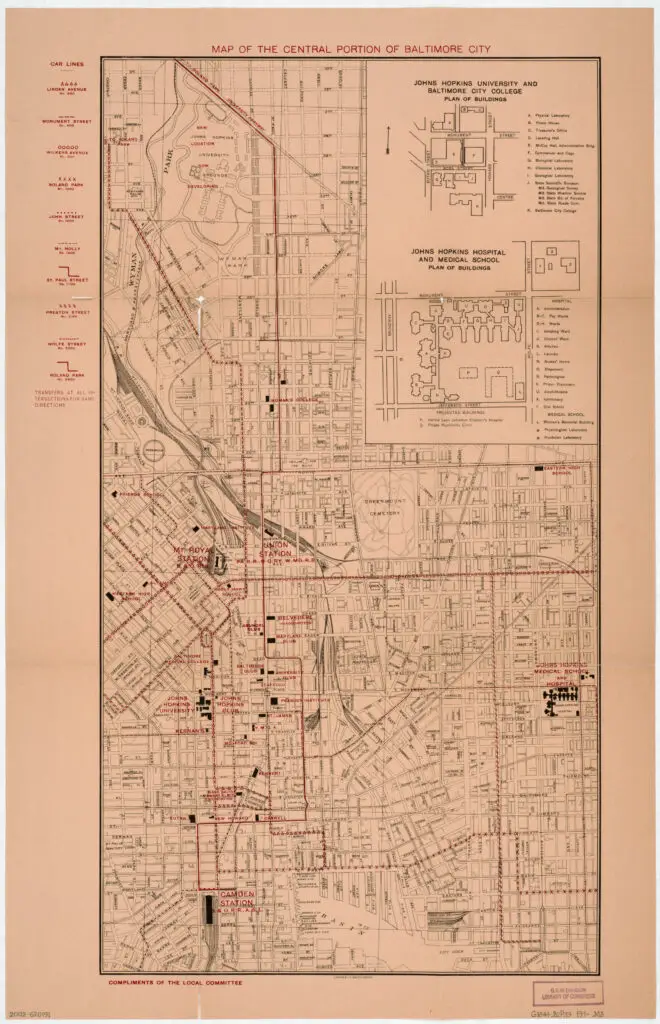
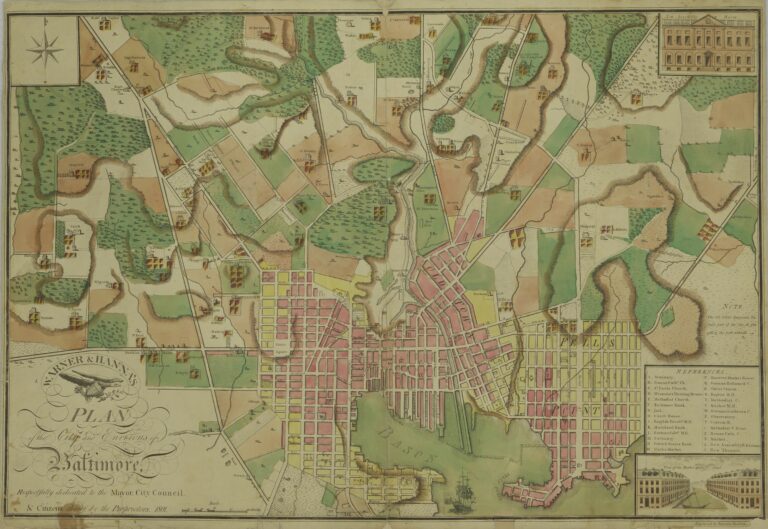
Exploring Central Baltimore Through a 100-Year-Old Map
Take a journey back in time and explore Central Baltimore through a 100-year-old map. See the streetcar lines, Johns Hopkins University, and Johns Hopkins Hospital in a whole new light!
-ad 103-
-ad 105-
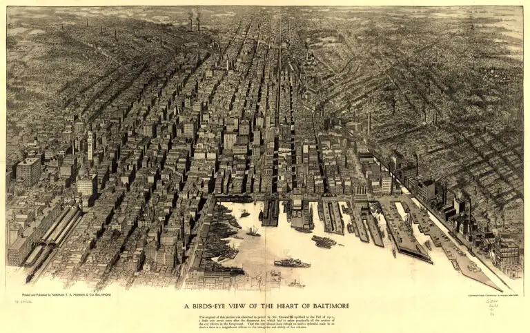
This great old map shows central Baltimore over 100 years ago.
Shows streetcar lines in black and other (new?/proposed?) lines in red overprint. Includes “Car lines” legend in red, inset of Johns Hopkins University with index, and inset of Johns Hopkins Hospital with index. (source: Library of Congress)