Skip to content
Neighborhoods
Bolton Hill
Canton
Catonsville
Federal Hill
Fell’s Point
Pigtown
Roland Park
Notable People & Places
Baltimore Harbor
Cal Ripken
Camden Yards
Ft. McHenry
The Best Of
Search
Search
Close this search box.
-ad 101-
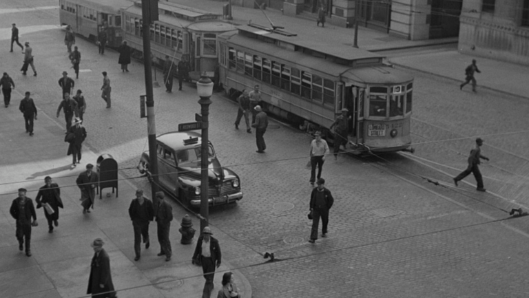
Journeying Back in Time: Baltimore's 1943 Trolley Commute
Relive 1943 Baltimore: A captivating trolley commute captured by photographer Marjory Collins. Step into the past as we explore this iconic moment...
Exploring a Fascinating Snapshot from the Historic American Buildings Survey: The Washington Monument and Two Historic Churches in Baltimore
Explore a fascinating snapshot from the Historic American Buildings Survey, featuring the Washington Monument and two historic churches in Baltimore....
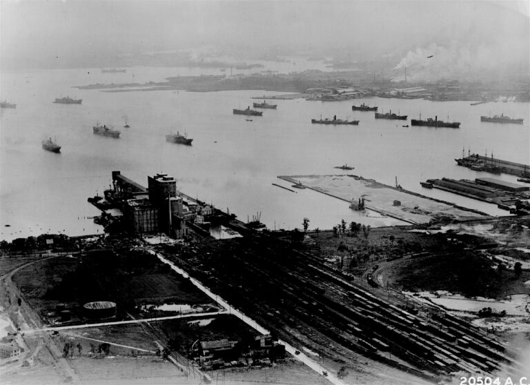
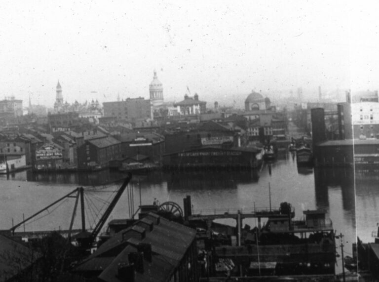
Capturing History from Above: The Magnificent Baltimore Harbor in 1920
This blog post explores an aerial photograph of Baltimore Harbor taken in 1920 by Captain Albert William Stevens of the US Army Air Corps. The...
-ad 188-
-ad 615-
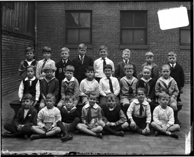
A Fascinating Look at a Class of Young Boys from The Boys' Latin School of Maryland
Take a look at this amazing old photo showing a class of young boys from The Boys' Latin School of Maryland. Fascinating to think what lives...
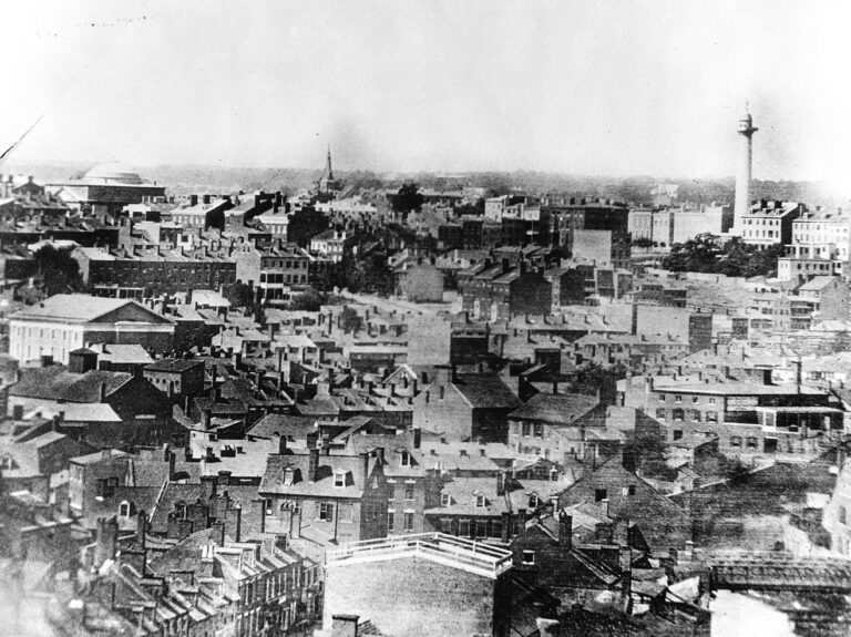
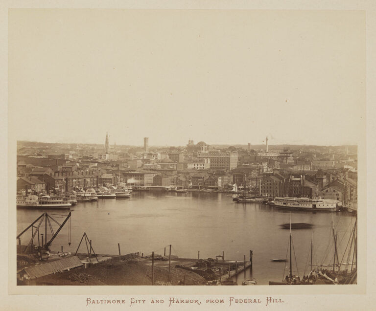
Incredible Old Photograph Showing Baltimore Harbor from Federal Hill in 1872
Discover an incredible old photograph from 1872 showing Baltimore Harbor from Federal Hill. Get ready to be fascinated by the details!
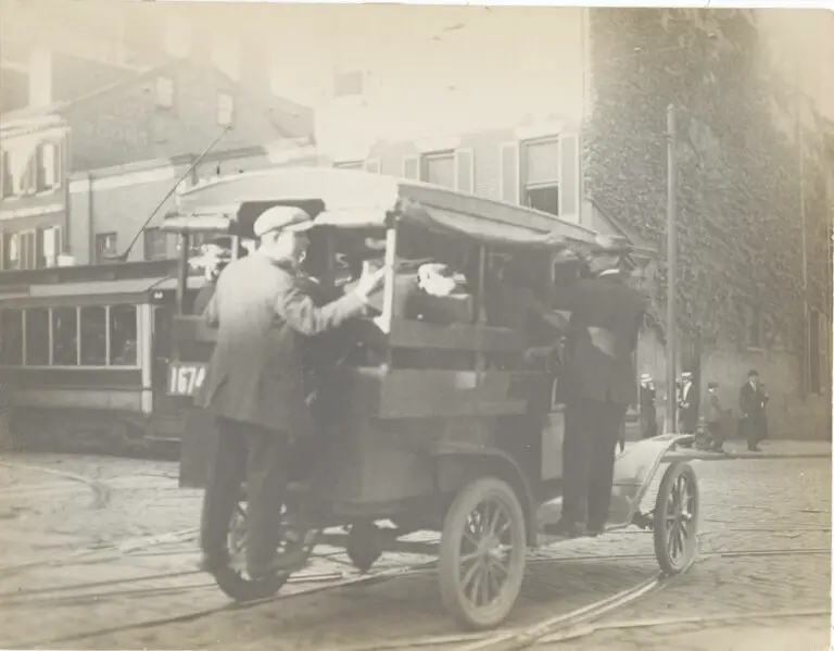
Exploring the Unsafe Practices of Jitneys in Baltimore in the 1910s
In the 1910s, the introduction of the automobile led to the adoption of jitneys as a preferred form of transportation in Baltimore. This post...
Today's Recommendation
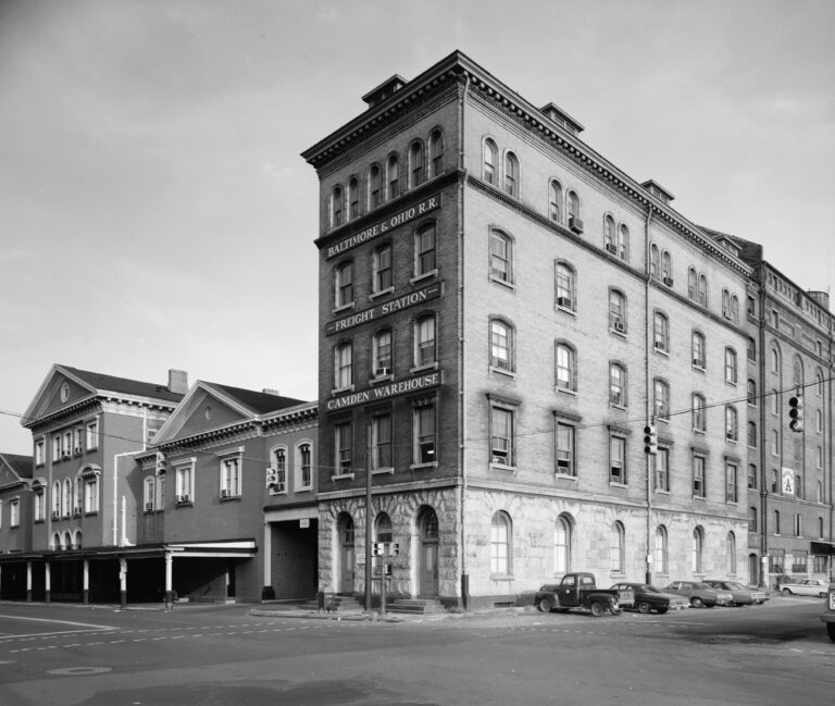
Exploring the Mystery of a 1970s Photo Near Camden Yards
Take a journey with us as we explore the mystery of a 1970s photo taken near Camden Yards. Can you help us figure out the perspective? Join us...
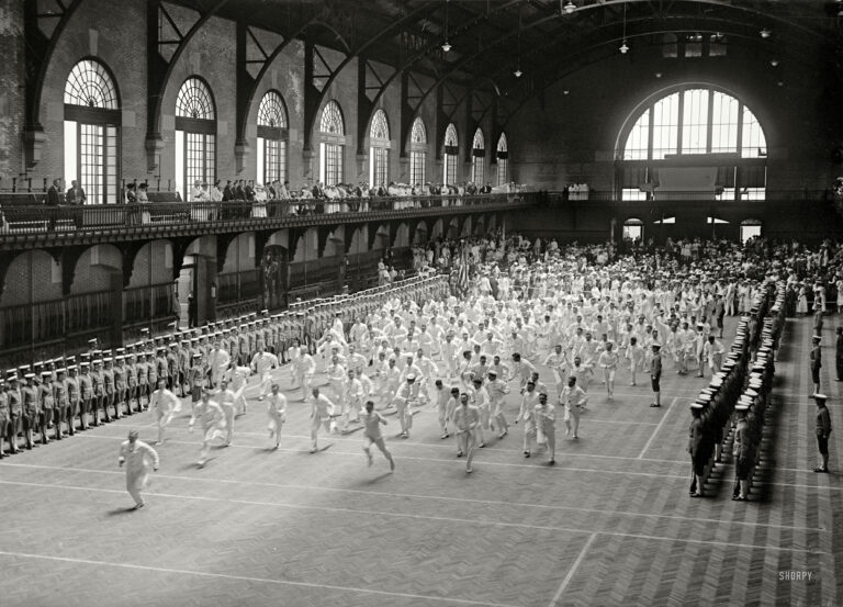
Witness 1917 US Naval Academy Graduation in Annapolis
Step back in time to 1917 and witness the graduation festivities at the US Naval Academy in Annapolis. Take a look at this stunning photograph...
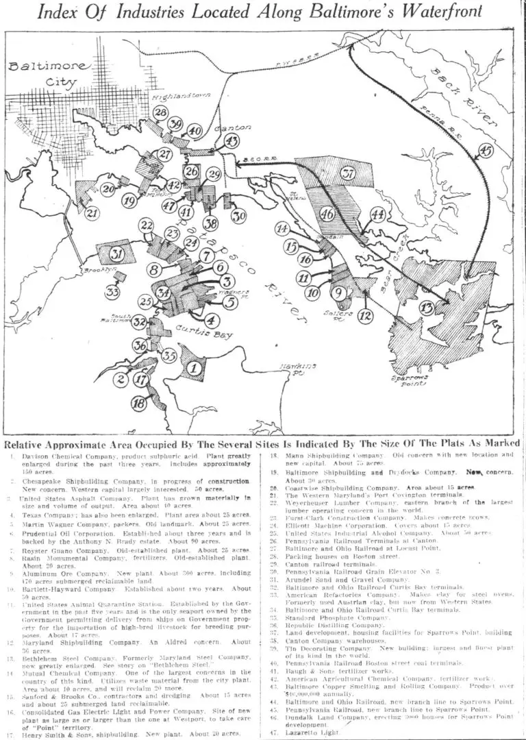
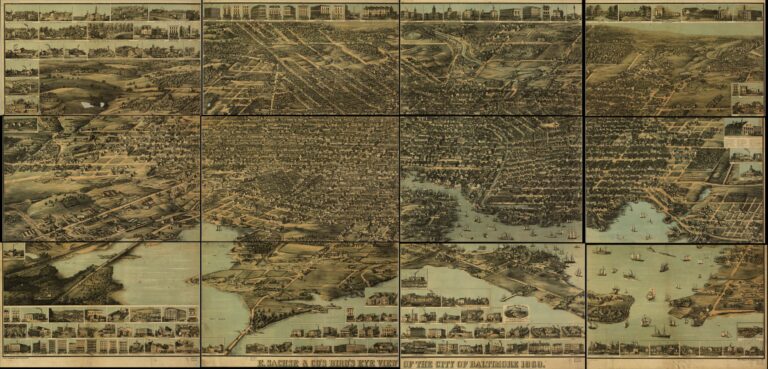
Explore Baltimore's Industrial Past with this Fascinating 100-Year-Old Map
Take a journey back in time and explore Baltimore's industrial past with this fascinating 100-year-old map. Click on it for more details and...
-ad 197 (p3)-
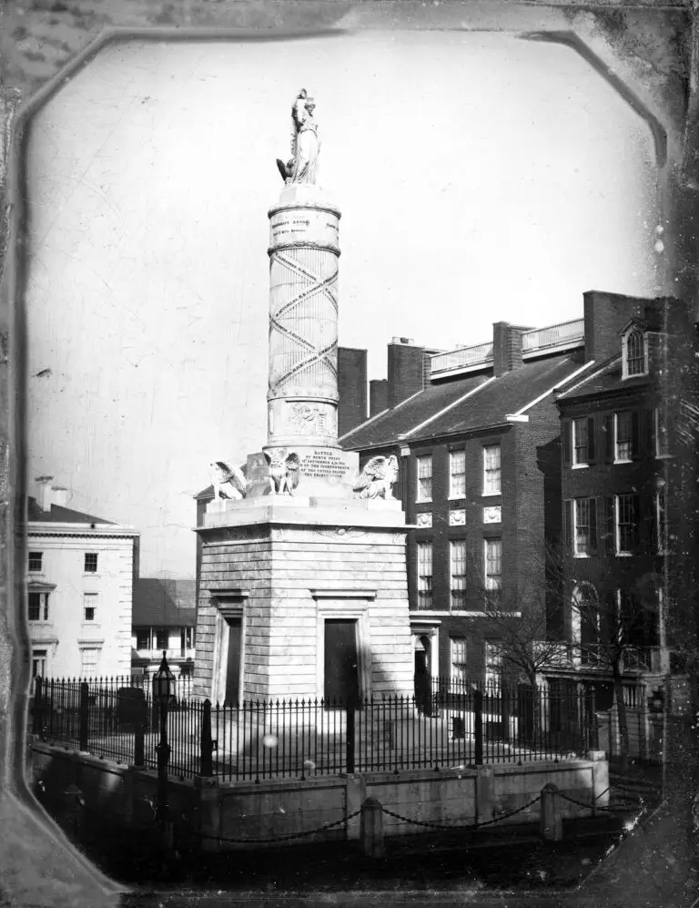
The Fascinating Old Photo of the Battle Monument on North Calvert from 1846
This fascinating old photo from 1846 shows the Battle Monument on North Calvert. It was taken by John Plumbe who also took the earliest known...
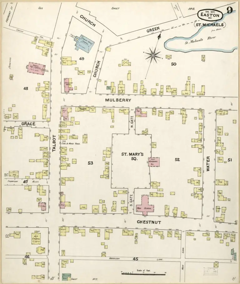
Exploring History Through Maps: Taking a Closer Look at the 1891 Sanborn Map of St. Michaels, Maryland
Explore the history of St. Michaels, Maryland with us as we take a closer look at the 1891 Sanborn Map. Click on each map for a larger, more...
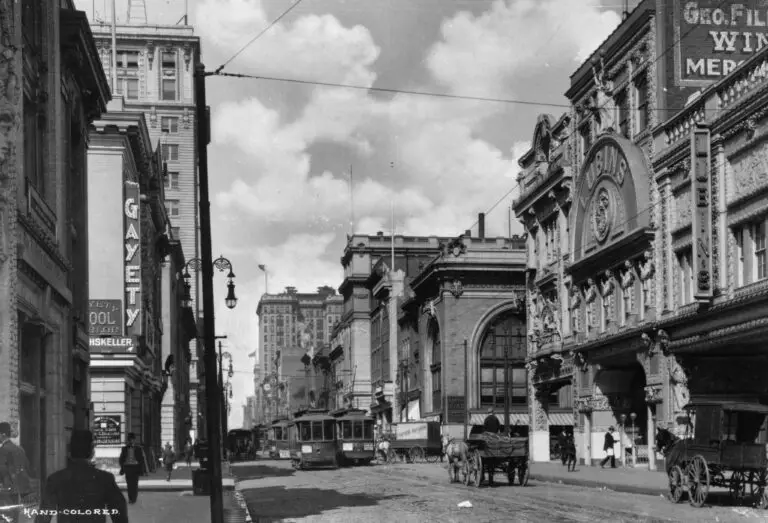
Exploring Baltimore's Historic Lubins Theatre on East Baltimore St
Visit GhostsofBaltimore.org to explore Lubins Theatre on East Baltimore St, an historic theatre in the heart of the city. See photos and read...
Today's Recommendation
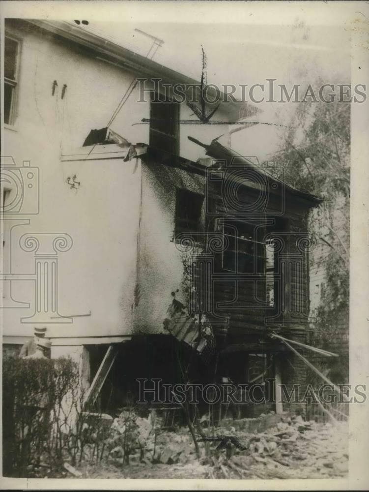
Baltimore Mayor William Broening's Home Destroyed by Bomb
Italian anarchists destroy Mayor William Broening's home with a bomb in 1927. Baltimore was placed on a war basis for protection soon after the...
Exploring Baltimore in 1904 Through This Rare Bird's-Eye Photo
Take a journey to Baltimore in 1904 with this rare bird's-eye view photo that we dug up from the Library of Congress. Explore the city with this...
Exploring Baltimore's History Through an Incredible Image at the Library of Congress
Take a journey through Baltimore's history with this incredible image from the Library of Congress. We explore the origins of this image and...
-ad 607 (p11)-
A Fascinating Look at History: Comparing a Painting from the 1830s to a Photograph from the 1930s
Take a look at these two amazing images from the Library of Congress. The first is a painting from the 1830s, and the second is a photograph...
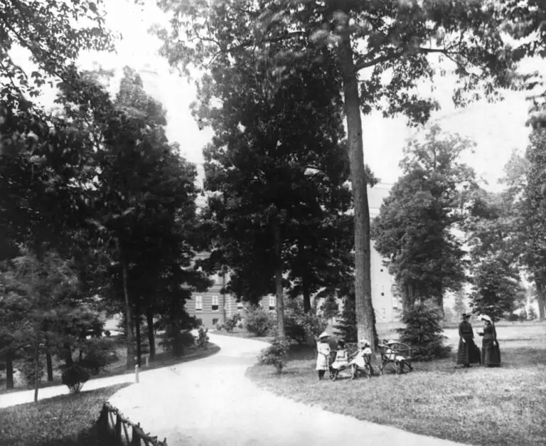
A Rare Look at Notre Dame Academy in the Late 19th Century
Take a rare look at Notre Dame Academy in the late 19th century, as captured by Frances Benjamin Johnston in a stunning photograph. See the amazing...
The Orioles and Baseball Go Back a Long Way: Celebrating the 1894 Pennant Race in Baltimore
Join us in celebrating the 1894 Baltimore Orioles pennant race! We take a look back at the wild celebrations that followed the Orioles' success...
-ad 617-
-ad 616-
JOIN OUR EMAIL LIST
Enjoy daily
Ghosts of Baltimore stories
SUBSCRIBE
No thanks.