Relive 1943 Baltimore: A captivating trolley commute captured by photographer Marjory Collins. Step into the past as we explore this iconic moment in the city's history.

Relive 1943 Baltimore: A captivating trolley commute captured by photographer Marjory Collins. Step into the past as we explore this iconic moment in the city's history.
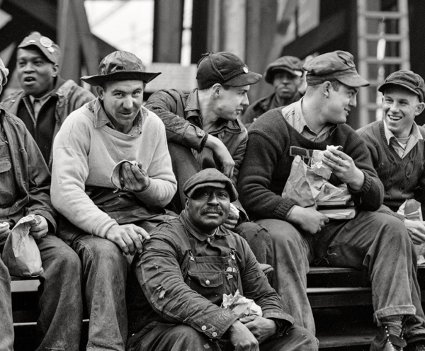
This photograph taken by Arthur Siegel in May 1943 captures a moment in time at the Bethlehem-Fairfield Shipyards in Baltimore, Maryland. It depicts workers on their lunch break or rest period, giving us a glimpse into the daily lives of those who contributed to the war effort by building cargo transports.
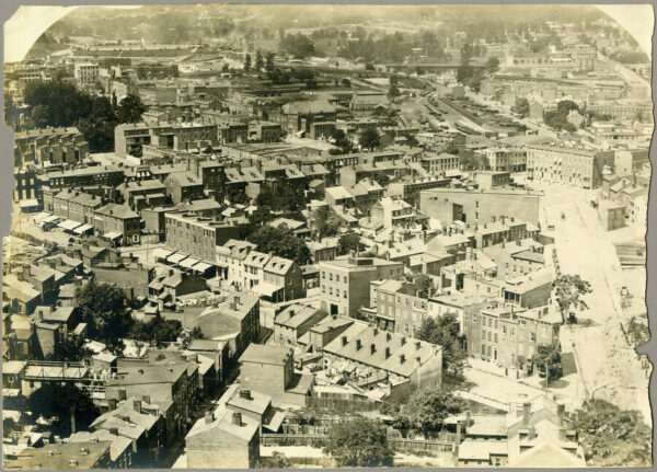
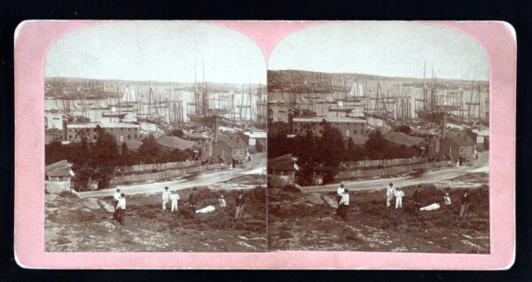
Take a journey back in time with William Henry Weaver's photographs of Baltimore in 1873, offering a unique glimpse into the city's rich history.
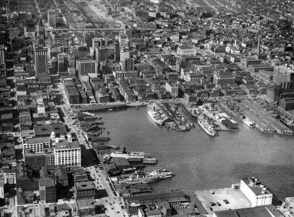
This stunning photo captures Baltimore Harbor in the fall of 1948, showcasing the city's bustling port and maritime culture. The harbor is filled with a diverse array of ships and boats, ranging from massive cargo ships to sleek sailboats. The city skyline can be seen in the background, with towering buildings rising up against the clear blue sky.
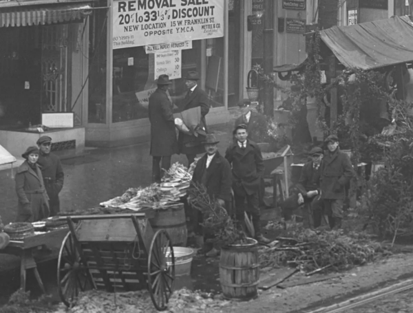
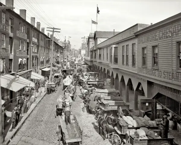
Step back in time to the bustling streets of 1920s Baltimore with a captivating photo of outdoor stalls on Eutaw St. at Marion. Explore the vibrant street life, colorful storefronts, and lively crowds that defined the outdoor market scene in this era. Discover the role that outdoor markets have played in shaping the city's history, as well as the importance...
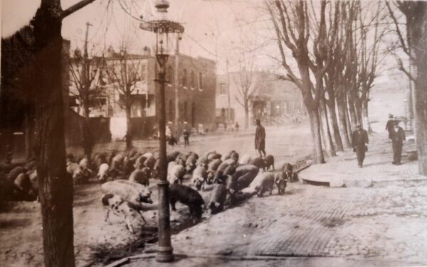
Take a look through time and explore Baltimore's Pigtown in the 1920s. See the sights and sounds of this historic Baltimore neighborhood with this incredible old film.
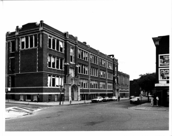
Explore the history of Frederick Douglass High School in West Baltimore, established in 1883 and known for alumni like Thurgood Marshall, Cab Calloway, and Kwase Mfume.
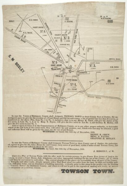
Map dated Dec. 14, 1853 which shows proposed lots for a courthouse, jail and alms house in Towson Town, Md., if it is chosen as the county seat of Baltimore County by the voters.
Discover an incredible old photo with stunning detail. Click on it for a detailed image that is just stunning. Source: Library of Congress.
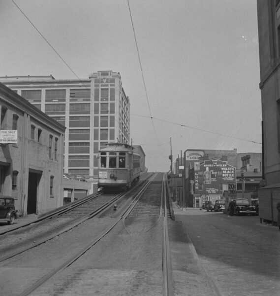
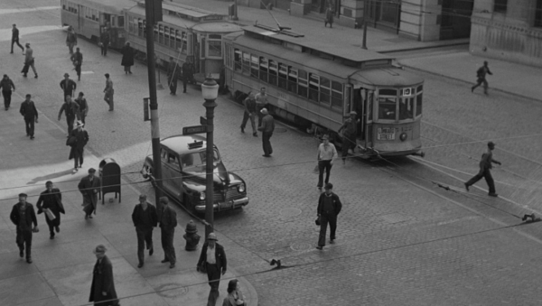
See an old image of Baltimore from 1943 - an elevated streetcar near the 200 block of Guilford Ave. Check out the Google Street View and let us know what you think in the comments!
Take a look at East Pratt St. in 1908 and today with this fascinating comparison. Click on the image to learn more about the history of this Baltimore street.
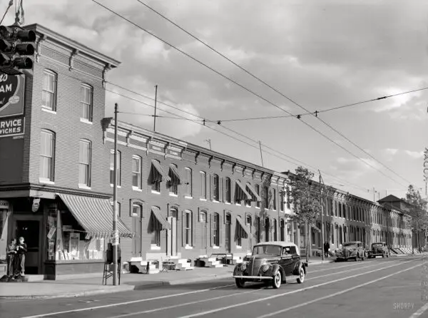
Relive the 1940s in Baltimore with this beautiful photo of row houses on Washington Blvd. and Bayard St. See what the same spot looks like today with a Google Street View!
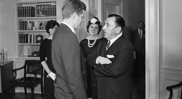
In 1949, Mayor D'Alesandro opposed a proposal for a new airport in Virginia due to the newly-built Friendship International Airport near Baltimore. Read the full story from our sister site, Ghosts of DC.
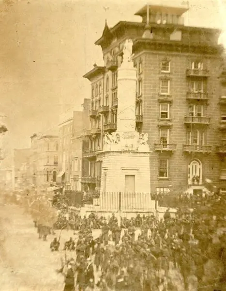
Explore the 6th Massachusetts Regiment in a Civil War photograph from the Library of Congress. Get a glimpse into the past as you admire this historic image.
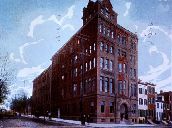
Take a look back in time with this amazing image of Baltimore Medical College as it looked in 1908. Source: National Institutes of Medicine.
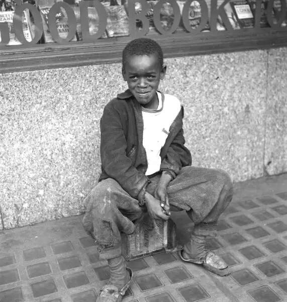
Explore the mystery of the Baltimore shoe shine boy, a figure seen in an iconic 1943 photo. What happened to him and why has he vanished? Learn more here!
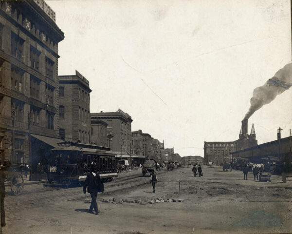
Take a look back in time to 1906 and explore the amazing view of Light Street in Baltimore. See the incredible photos and learn more about this historic street.
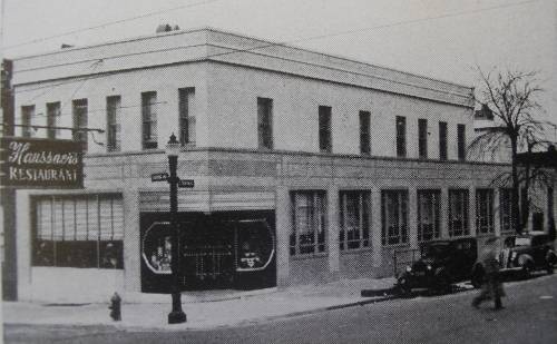
Haussner's Restaurant was one of Baltimore's most famous landmarks, known for its cuisine and extensive art collection. Learn more about the history of this iconic restaurant, which was even featured in AMC's Mad Men!
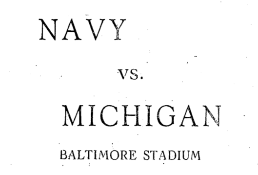
Take a trip back in time to October 30th, 1926 when Navy faced off against Michigan in a football game. Check out this old newspaper advertisement and relive the excitement of Navy's 10-0 victory!
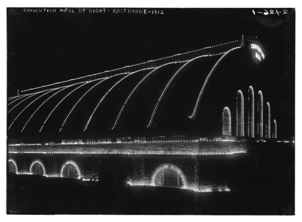
Get a glimpse into the past with this rare 1912 photo of the Fifth Regimental Armory in Baltimore, taken during the Democratic National Convention of that year.