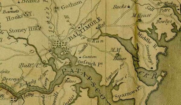
Take a journey through time with this 1822 map of Baltimore! Discover the city's vibrant and dynamic history and culture, and explore the ways in which it has evolved over the years.

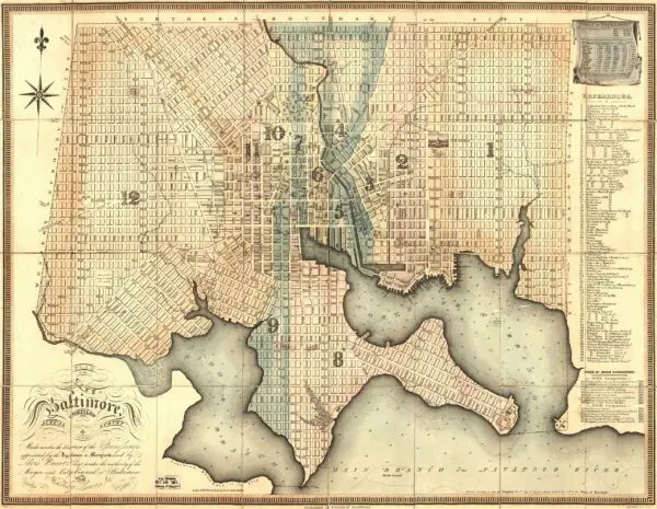
Take a journey through time with this 1822 map of Baltimore! Discover the city's vibrant and dynamic history and culture, and explore the ways in which it has evolved over the years.
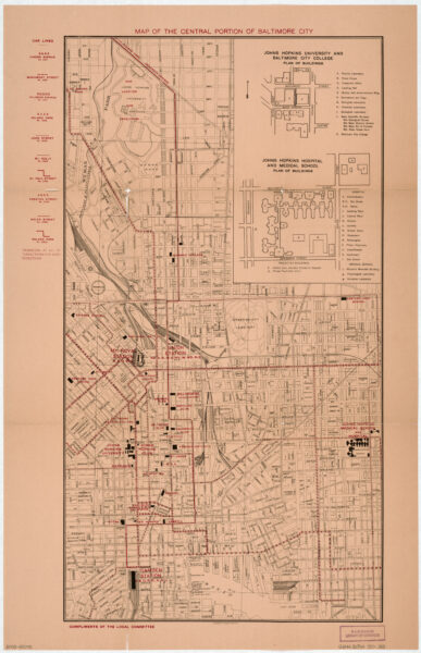
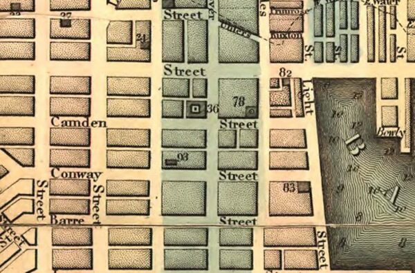
Take a journey back in time and explore Central Baltimore through a 100-year-old map. See the streetcar lines, Johns Hopkins University, and Johns Hopkins Hospital in a whole new light!
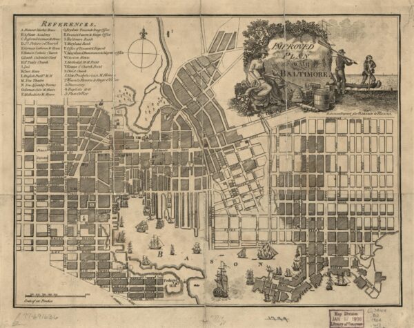
Explore the history of Baltimore with this beautiful 1804 map. Learn more about the city's past and discover the many places that have changed over the past two centuries.
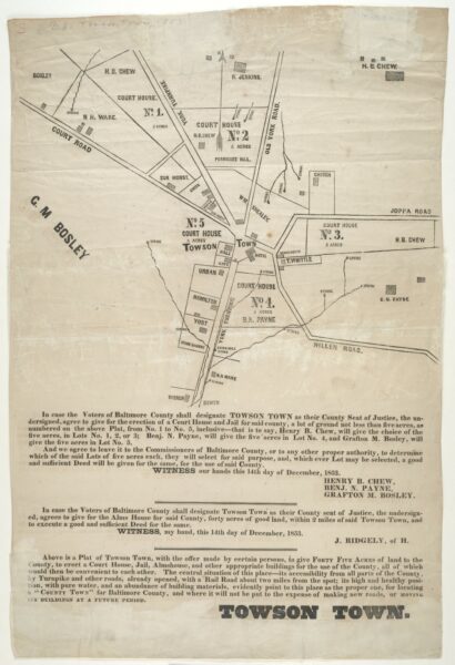
Map dated Dec. 14, 1853 which shows proposed lots for a courthouse, jail and alms house in Towson Town, Md., if it is chosen as the county seat of Baltimore County by the voters.
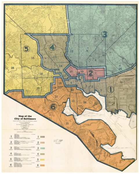
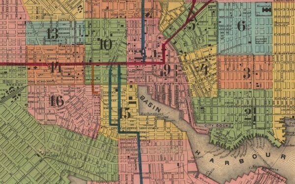
Take a look back at Charm City in 1935 with this detailed old map. Click on it to explore the streets and wards of Baltimore in 1935.
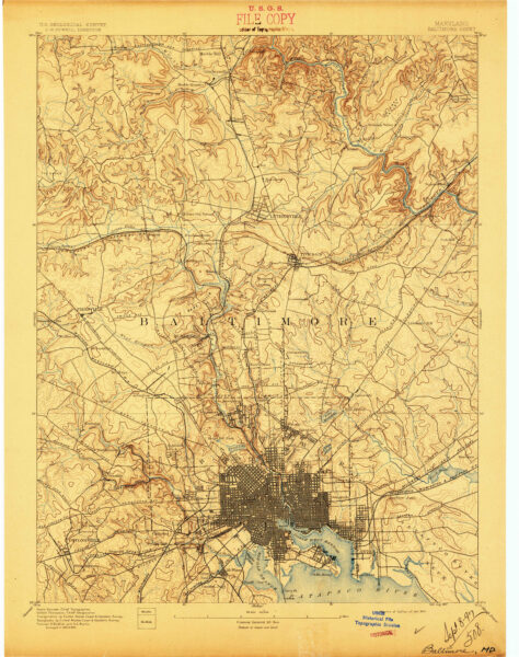
Explore the City of Baltimore in 1894 with this amazing historical topographic map. See the city's roads, buildings and landmarks and discover the history of Baltimore!
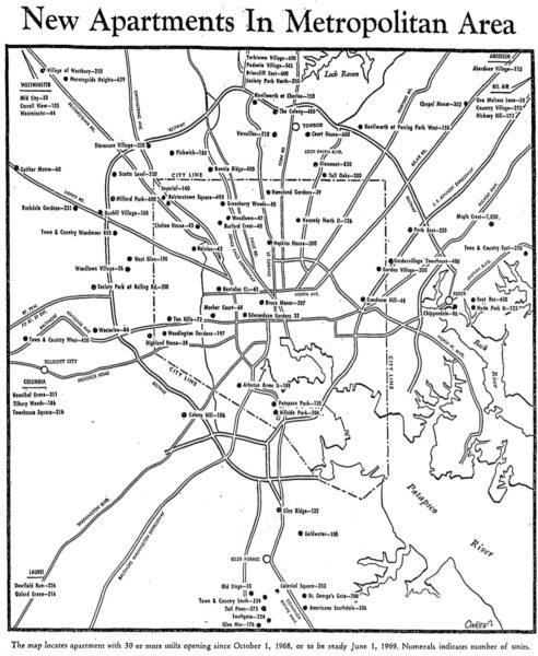
Take a look back in time to the Baltimore housing market of 1969. This old advertisement from The Baltimore Sun highlights the number of new apartments available in the Baltimore area that summer. Click to learn more!
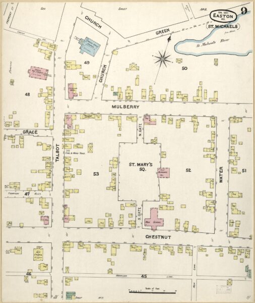
Explore the history of St. Michaels, Maryland with us as we take a closer look at the 1891 Sanborn Map. Click on each map for a larger, more detailed version.
Take a journey through Baltimore's history with this incredible image from the Library of Congress. We explore the origins of this image and its significance to understanding Baltimore's past.
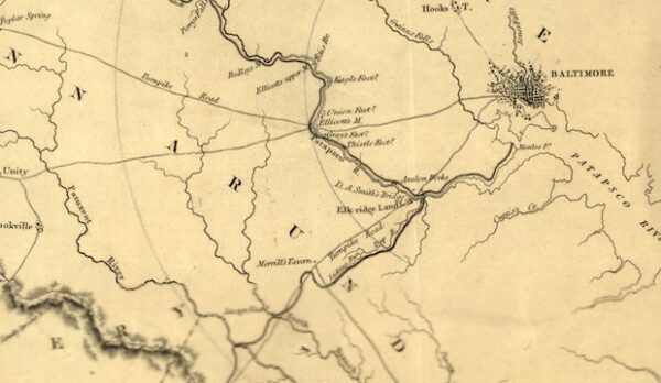
Take a look at this fascinating map from 1838, showing a potential route for a canal between Baltimore and Washington. Uncover the forgotten plan to connect the two cities with this incredible map from the Library of Congress.
Learn about the fascinating history behind the street names of Baltimore in this old article from 1914. From King George to Lord Baltimore, find out how the city's original settlers were influenced by the mother country and the royal family.
Explore Baltimore's past with this 1848 travel map. Click on it for a larger version and discover the city's history! Source: University of Texas Libraries.
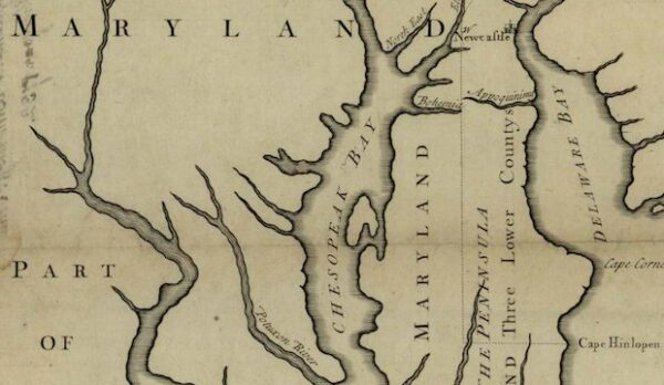
Explore a rare look at history with this 1795 map of Maryland. Learn more about cities, towns, and public buildings of the time and click on the map to view a larger version.
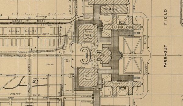
Dive into the past with this amazing map of the Naval Academy campus in 1924. Take a look into history and explore the campus of the United States Naval Academy in Annapolis, Maryland.
Take a look at this 1732 map of Maryland and neighboring states by the namesake of Charm City, Lord Baltimore. Learn more about this important historical landmark and its significance today.
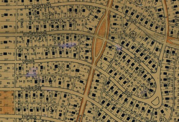
Take a trip back in time and explore Roland Park in 1941 with this amazing map from the University of Maryland. Thanks to the awesome collection available there!
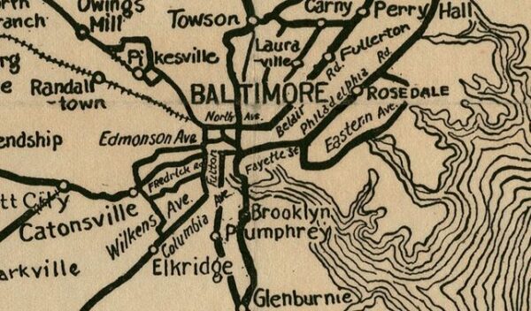
Take a trip back in time and explore the countryside outside of Baltimore with a 1920s automobile. Get your map ready and learn more about the history of the area with this blog post.
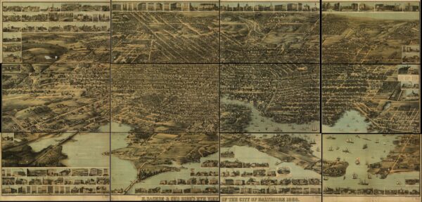
Dive into Baltimore's past and explore F. Klemm's 1873 map of Baltimore and its suburbs. View the map from the Johns Hopkins digital collection and uncover a historical perspective of the city.
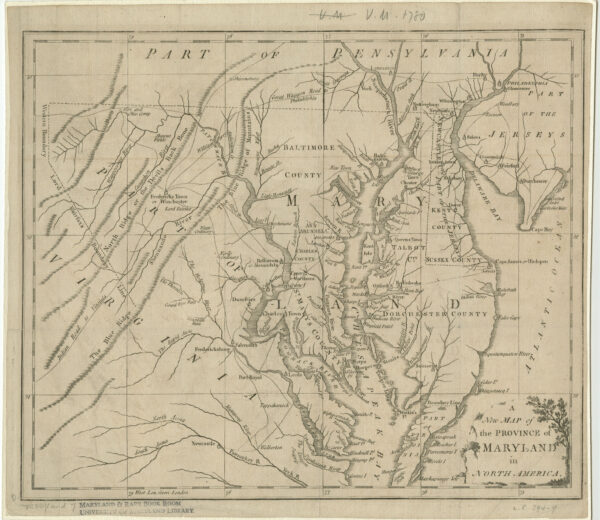
Take a journey back to 1780 and explore the Province of Maryland on an old map. See the historical boundaries before Washington, D.C. was established and examine the geographical features of the area.
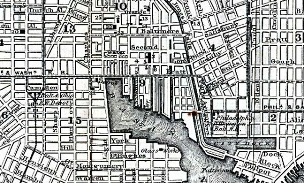
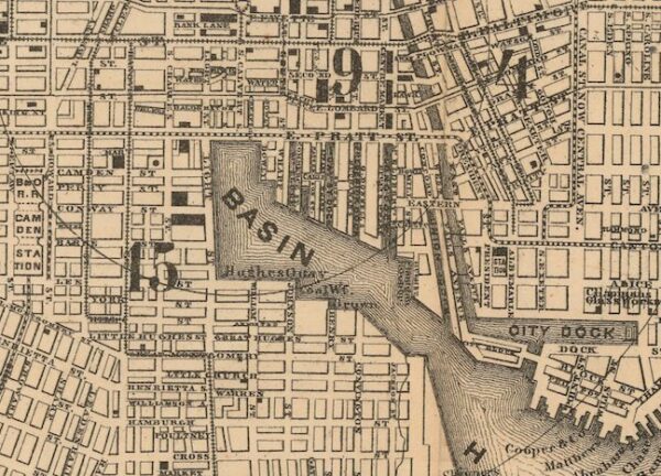
Take a look back in time and explore Baltimore in 1872 with the Johns Hopkins digital collection. See the detailed map and learn more about the city's history.