
Before Harborplace, the watermelons came off the Bay boats on Pratt Street one at a time, by hand. The writers of the 1940 WPA guide to Maryland watched it happen at the Basin, the old inner harbor at the foot of downtown Baltimore.
The dock is busiest during watermelon season. All unloading is done by hand. A human chain is formed from the deck or hold of the vessel to the buyer’s vehicle, sometimes across one or more intervening craft, and the watermelons, one by one, are thrown from man to man and inspected in transit by the buyers, who usually form part of the chain.
Inspected in transit! That’s a quality-control system I’d pay to watch, and it happened a few steps from where Harborplace would open 40 years later.
For more than a century, the Light Street wharves on the Basin’s west side and the Pratt Street wharves on its north side were where Baltimore met the Bay. Harborplace’s two pavilions went up on that corner in July 1980. Now they’re slated for demolition, though tenants have been told they can stay open through New Year’s and into early 2027.
The Basin before the piers
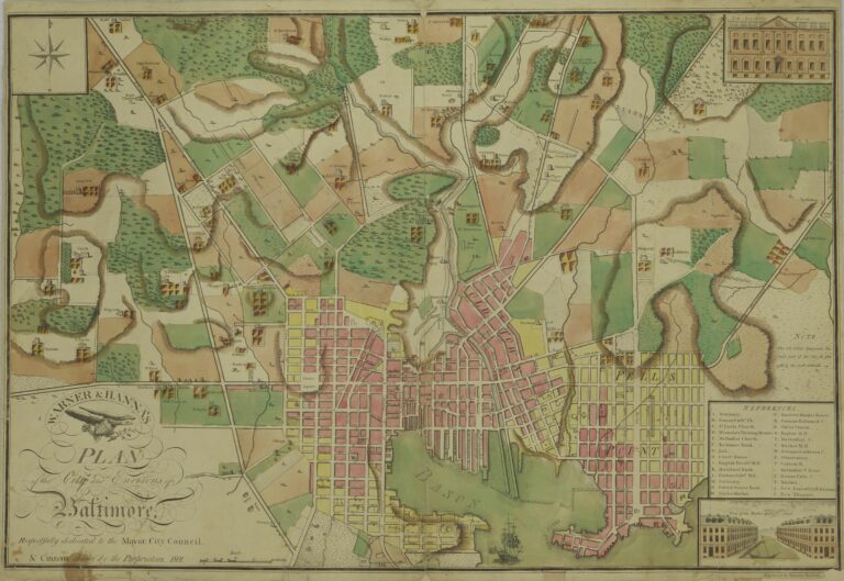
The harbor used to come much farther inland. A National Park Service engineering survey of the Inner Harbor puts the early shoreline at Water Street. That’s about two blocks north of today’s waterfront.
By 1800, landowners had filled the marsh south of Water Street and pushed long finger piers out into the water. The 1940 WPA guide notes that this stretch of Pratt Street was once under water. (We’ve written about how Pratt Street got its name, too.)

The Basin was shallow, though, and the same survey says the piers had only about 18 feet of water. That was fine for Bay steamers but not for deep-draft ocean ships. So the Inner Harbor became the Chesapeake’s front door, while the big freighters went to Locust Point, Canton and Fells Point.
Where the Bay came to town
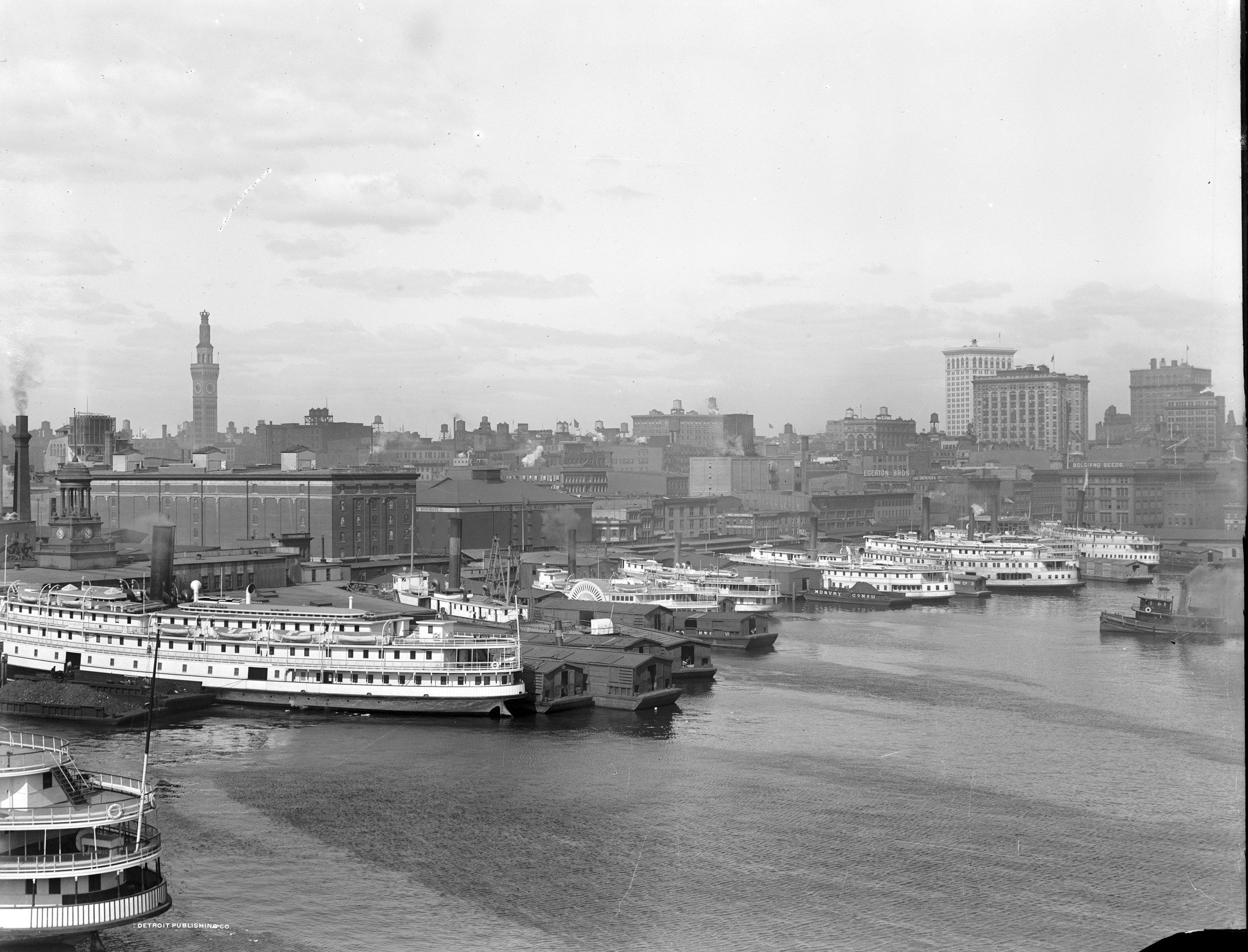
Chesapeake Bay steamboats and local trade ruled the Inner Harbor until World War II, the survey says. From Light Street you could catch a boat to Norfolk, the Eastern Shore or an excursion park down the Bay.
The 1940 WPA guide reads like a timetable. Light Street’s Pier 5 had the Love Point ferry, Pier 8 had the Wilson Line’s excursion steamer Dixie, and Pier 16 had the Tolchester ferry. Pier 10 was the Baltimore Steam Packet Company’s.
That company was better known as the Old Bay Line. It was organized in 1840 and ran overnight boats to Norfolk, according to Alexander Crosby Brown’s 1961 history of the line.

The line came to Light Street because of a fire. On the night of May 17, 1898, fire destroyed its old terminal at Union Dock, Brown writes, so the incoming Alabama tied up at Pier 10, Light Street, instead. The company then bought the Light Street property and built offices topped by a tower “familiar to countless travelers.”
Light Street was narrow and crowded then, so the company built an overpass across it. According to Brown, its riders “are not compelled to cross the bed of Light Street” and risk the passing teams. I love that the selling point was not getting run over by a horse.
Cattle, oysters and one very large hog
The steamers hauled the farms of the Eastern Shore and Virginia into the city, and livestock came by water too. In the 1920s and 1930s, Washington’s Evening Star ran a Baltimore livestock column that quoted cattle prices “at Light street wharves.”
The oddest arrival we found came in September 1906. The Baltimore American wrote it up, and a Baltimore County paper reprinted the story.
Sunday school pupils, early churchgoers and passengers arriving on steamers at the Light street wharves yesterday morning were treated to a free show of what is claimed to have been the largest hog ever landed along Light street.
The story said the hog weighed 1,500 pounds (its headline said 1,600) and came up from Norfolk on the Old Bay Line’s Alabama. Its owner said he’d taken in $800 in four days showing it at fairs.
Eight hundred dollars … to look at a pig.

Around the corner, the Pratt Street side was the working boats’ turf. Bay craft, power and sail, tied up “sometimes three or four deep” and sold their cargoes right there, according to the WPA guide.
The street behind the boats matched, with “dingy lunch rooms, sailors’ rooming houses, taverns, sailmakers’ lofts, ship chandlers’ stores.” According to the same guide, you could buy a foghorn, an anchor or a catfish sandwich on one block. (You can see the oyster boats up close in this photo of oyster luggers at Baltimore’s docks.)

The fire of 1904 and a city-owned harbor
The Great Baltimore Fire of February 1904 burned right down to the water. According to the Park Service survey, it destroyed every structure on the Pratt Street piers except the Pratt Street power plant.

The old piers hadn’t been much to begin with. In 1906, the Burnt District Commission described what the fire had wiped out.
The wharves were in even worse condition, many of the docks being nothing more than mud holes, and so narrow that no modern vessel of even moderate size could get beyond the ends.
So Baltimore took the waterfront. The city condemned the privately owned piers and built six new municipal piers south of Pratt Street, according to the same survey. Owners fought the condemnations, and the municipal Pier 5 off Pratt Street wasn’t finished until 1910, according to a companion survey.
Light Street got wider too. Brown writes that the city condemned property on the west side of the street, and the overpass came down. The Bay Line’s terminal was rebuilt after the 1904 fire, burned again in February 1911, and came back with a four-faced clock on its tower.
Fire, trucks and the end of the night boats
In May 1941, a fire swept the Light Street waterfront and destroyed two century-old wharves and the excursion steamer Tolchester, the Worcester Democrat reported. In October 1950, the Old Bay Line sold its Light Street terminal to the city for $569,420, Brown writes.
The city wanted to clear the “rickety piers, warehouses and terminal offices” along Light Street for a waterfront parkway, so the old terminal was razed. The line moved to Pier 3 on Pratt Street that December.
Brown, writing in 1961, pointed especially to competition from trucks, and the Chesapeake Bay Bridge made trucking the Bay a lot easier when it opened in 1952. After the bridge, Eastern Shore produce could reach Baltimore in about four hours, according to a 1957 newspaper clipping cited in the Park Service survey. By boat, the trip had taken three days.
The Bay Line’s passenger boats were laid up in the fall of 1961 “just for the winter.” They never came back. On April 3, 1962, the Sun reported that the line, the last overnight passenger steamship line in the country, was going out of business after 122 years.
An empty waterfront
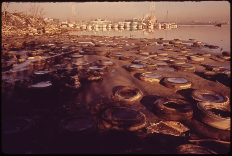
The Marsh Market, the wholesale market two blocks north of the piers, closed in 1960, the survey notes. The old Light Street piers came down, and in 1970 the city filled about 100 feet of the harbor along Light Street behind new seawalls.

In 1963, Mayor Theodore McKeldin stretched the renewal zone for Charles Center, the downtown rebuilding project begun in 1958, down to the water. The Philadelphia firm Wallace, McHarg, Roberts and Todd drew a master plan for about 250 acres around the Basin, and the Inner Harbor Master Plan followed in 1964.
For most of the 1970s, the old steamboat landing was surface parking and festival space. The Baltimore City Fair set up there, and the tall ships came for the Bicentennial in 1976.
Harborplace
Then James Rouse, the developer who built Columbia, proposed a “festival marketplace” on the corner. Mayor William Donald Schaefer had reportedly vowed that nobody would build on the Inner Harbor while he was mayor, but he backed this one. Opponents gathered more than 10,000 signatures to keep the land a park.
On November 7, 1978, Baltimore voted. “Harborplace gets go-ahead,” the Sun announced the next morning. About 54 percent of voters approved.
Construction began in January 1979, and the $18 million project opened on July 2, 1980 (some accounts say July 3). More than 100,000 people came.

Now the pavilions are on their way out. MCB Real Estate plans a $900 million project in their place, including apartment towers of 32 and 25 stories. City voters cleared the way in November 2024, when Question F passed with 60 percent of the vote.
MCB said in June 2026 it was aiming to begin demolition in the last quarter of the year. In September, seven city residents sued to stop the demolition.
In 1940, the WPA writers looked at this waterfront and noted that Baltimoreans had “never made any attempt to recapture part of it from business.” In 1978 the city finally voted on what its waterfront should be. It chose shops, on the spot where men once tossed watermelons hand to hand off the Bay boats.
AI helped research and write this story. Here’s how we use AI.Suggest a correction